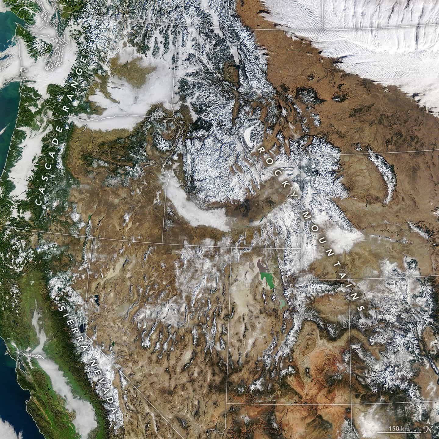
"This image, acquired with the MODIS (Moderate Resolution Imaging Spectroradiometer) on NASA's Terra satellite, provides a wide view of meager western snow cover on January 15. On that day, measurements derived from satellite observations showed that snow blanketed 142,700 square miles (369,700 square kilometers) of the west. That's the lowest coverage for that date in the MODIS record dating back to 2001 and less than one-third of the median. Coverage had increased slightly by January 26."
"In addition to snow cover area, snow water equivalent (SWE)-the amount of water stored in the snowpack-is an important indicator of winter conditions in the West. In early January, the National Integrated Drought Information System reported that snow drought, defined as SWE below the 20th percentile for a given date, was most acute in Washington, Oregon, Colorado, Utah, Arizona, and New Mexico. At least one ground-based monitoring station in every major western watershed recorded the lowest SWE in at least 20 years on January 26."
Western U.S. mountains had unusually low snowpack in early 2026 because warm temperatures caused much precipitation to fall as rain. MODIS measurements on January 15 showed snow covered 142,700 square miles, the lowest coverage for that date in the MODIS record since 2001 and less than one-third of the median. Snow water equivalent (SWE) values were below the 20th percentile in several states, and at least one ground-based station in every major western watershed recorded the lowest SWE in at least 20 years on January 26. The 2025–26 water year was generally wet, but record warmth and warm events like a December atmospheric river produced rain instead of snow. The Southern Sierra and Northern Rockies showed some localized increases in snow.
Read at SnowBrains
Unable to calculate read time
Collection
[
|
...
]