"A Blizzard Warning is in effect tonight across the Cascades, including Stevens Pass, Mount Baker, Snoqualmie Pass, Crystal Mountain, White Pass, and the Olympics. Wind gusts will reach 50 to 60 mph with visibilities potentially dropping below a quarter mile. Travel on mountain passes Wednesday night should be avoided entirely."
"Once the blizzard clears, a Winter Storm Warning takes over through Saturday morning. The NWS is forecasting 1 to 3 feet of additional accumulation across a wide corridor covering Baker, Stevens, Snoqualmie, Crystal, and White Pass. The Olympics are included as well, with Hurricane Ridge expected to receive 1 to 3 feet of snow alongside gusts up to 40 mph."
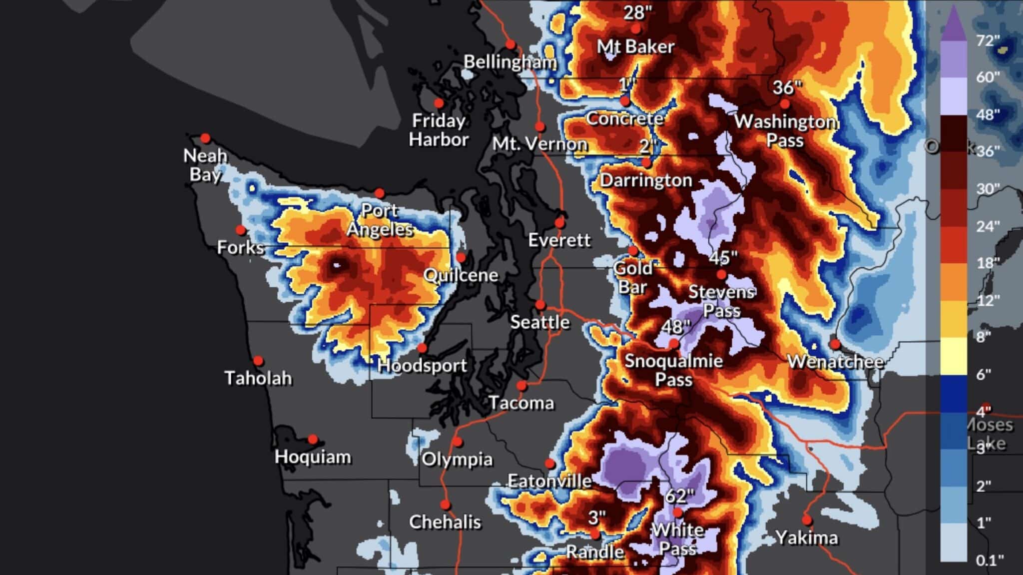
"Stevens Pass is positioned for the heaviest totals in the state. A separate warning sequence from NWS Spokane covers Western Chelan County across all three storm phases, with combined accumulations potentially approaching 4 feet by Saturday morning."
A significant multi-day storm is impacting the Washington Cascades with two distinct phases. Phase One features a Blizzard Warning from Wednesday 6pm through Thursday 5am, bringing wind gusts of 50-60 mph and visibility below a quarter mile across major ski areas including Stevens Pass, Mount Baker, Snoqualmie Pass, Crystal Mountain, White Pass, and the Olympics. Phase Two consists of a Winter Storm Warning from Thursday 5am through Saturday 5am, forecasting 1-3 feet of additional snow accumulation across the same regions. Stevens Pass is positioned for the heaviest totals statewide, with Western Chelan County potentially receiving up to 4 feet combined. Snow levels will rise briefly Wednesday night before colder air returns Thursday, ensuring all-snow conditions through the weekend at upper elevations.
#winter-storm-warning #blizzard-warning #washington-cascades #heavy-snow-accumulation #mountain-pass-travel-safety
Read at Unofficial Networks
Unable to calculate read time
Collection
[
|
...
]