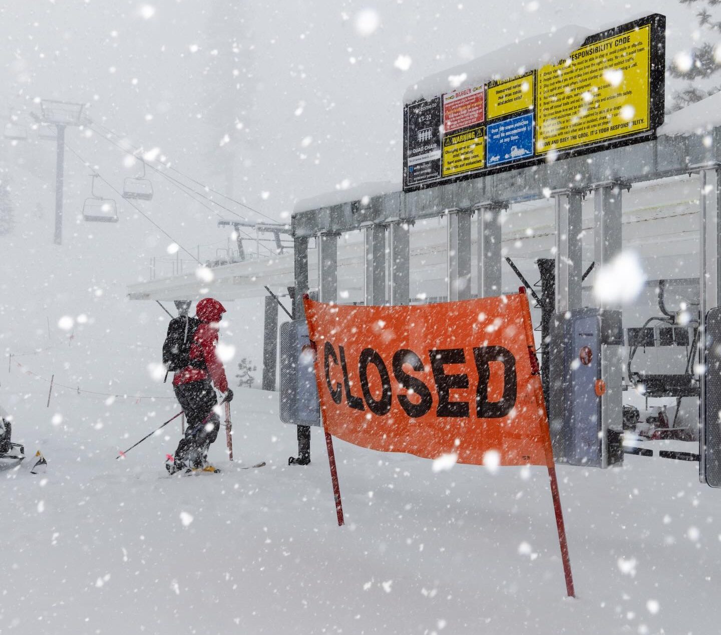
"Cold air wrapping into the system has produced exceptionally light, low-density snow-"a true midwinter treat," according to the resort-but that same combination of wind and heavy accumulation has created a highly complex and hazardous operating environment. After opening lifts Tuesday morning, the resort was forced to close by mid-day."
"If forecasts verify, Palisades Tahoe could see an additional 50 inches of snow by week's end, pushing storm totals into truly massive territory. While powder seekers may celebrate, the intensity of the storm presents serious operational challenges. Avalanche danger remains considerable as fresh snow continues to rapidly load onto an existing snow surface that is not strongly bonded. That combination requires extensive mitigation work before terrain can reopen."
A powerful Pacific storm brought deep moisture and cold air into the Sierra Nevada, producing over 30 inches of snow in 12 hours at 8,200 feet and unusually low snow levels. The storm delivered intense snowfall, strong winds, and rapidly deteriorating visibility, prompting Palisades Tahoe to close mid-day for guest and employee safety. Cold air produced exceptionally light, low-density snow, while heavy accumulation and winds created hazardous operating conditions. Forecasts suggest up to 50 additional inches could fall this week. Avalanche danger is considerable as fresh snow rapidly loads on weakly bonded surfaces, requiring extensive mitigation before reopening terrain.
Read at SnowBrains
Unable to calculate read time
Collection
[
|
...
]