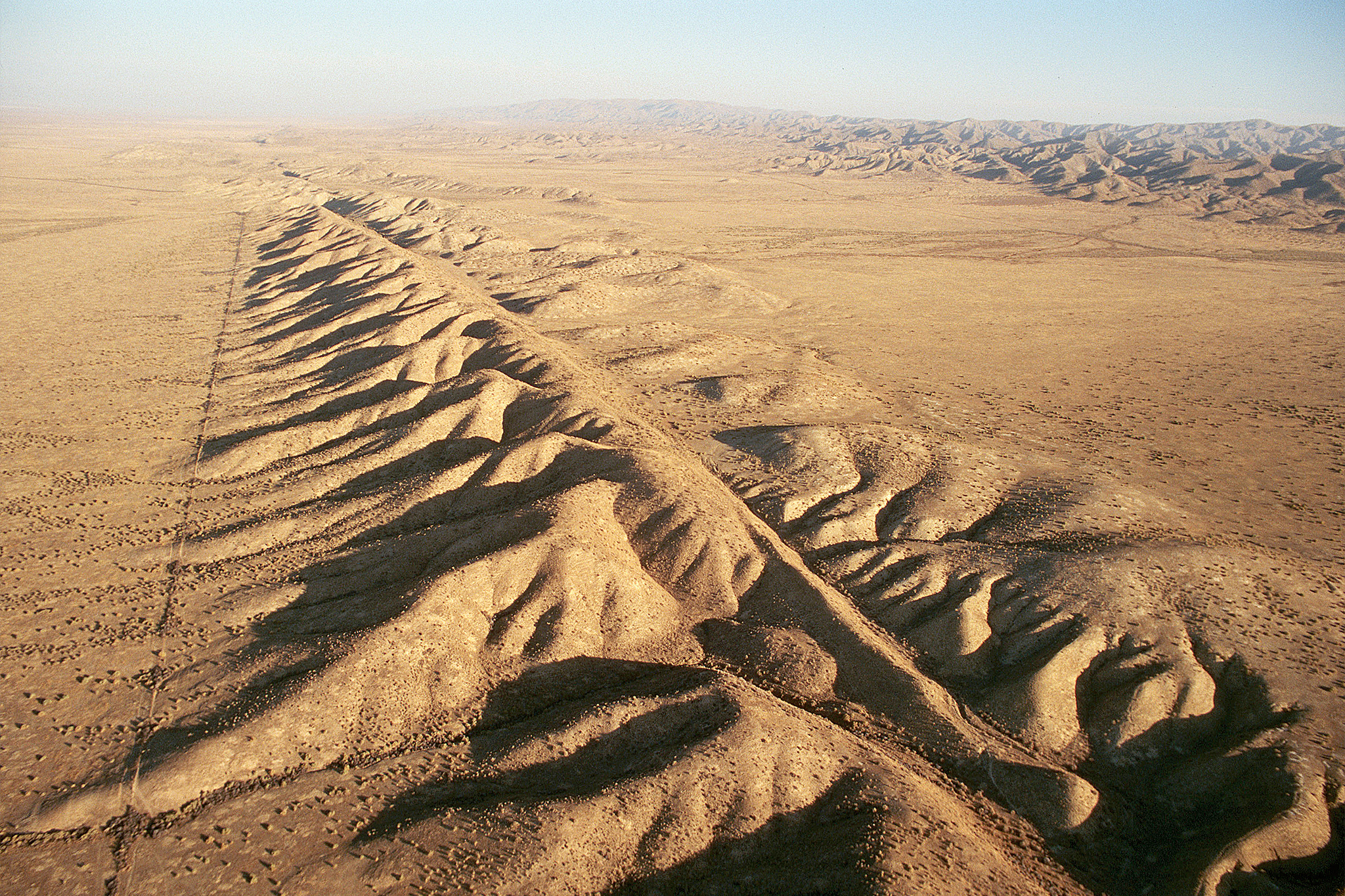
Californians learn "Drop, Cover, Hold on" to stay safe during earthquakes. Scientists forecast a greater than 99% chance of magnitude 6.7 or larger quakes in California over the next two decades, while the probability of magnitude 8 or higher is about 7% statewide. Experts advise focusing on preparing for more frequent magnitude 5–6 events rather than fixating on rare megaquakes. The San Andreas Fault Zone separates the Pacific and North American plates, with the Pacific plate moving northwest roughly 2 inches per year, producing intermittent slips that cause earthquakes. A 2014 30-year rupture forecast mapped likely magnitudes and locations and found higher 6–7 risks in the Bay Area and greater 7.5+ risk in southern California.
"The infamous San Andreas Fault Zone - a system with the main fault and many near-parallel faults - runs across much of California, dividing the Pacific tectonic plate from the North American one. The Pacific plate moves northwest about 2 inches per year, meaning Los Angeles is creeping toward San Francisco. The unsteady sliding between the two plates plays out in fits and starts. Sudden slips lead to earthquakes, which release the pent-up energy."
"In 2014, leading scientists from different fields developed the 30-year earthquake rupture forecast, which estimated the magnitudes, locations and likelihood of potentially damaging temblors in California. It considered fault "readiness," where earthquake likelihood builds up on faults that haven't ruptured in a while. Overall, the forecast predicted that the probability of magnitude 6 and 7 earthquakes is a bit higher in the San Francisco Bay Area than the Los Angeles region."
Read at SFGATE
Unable to calculate read time
Collection
[
|
...
]