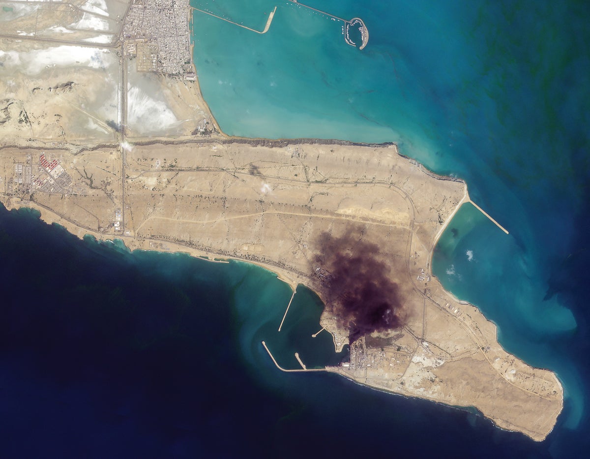
A satellite company sent a media release the day after the U.S. and Israel began a war with Iran, sharing early images of airstrike impacts. The company operates a large constellation of remote-sensing satellites that can capture images across much of Earth frequently. Governments, journalists, and ordinary observers can view developments soon after they occur because satellites continuously observe the planet. The growth of commercial remote sensing is moving society toward near-real-time geospatial intelligence for many people. While the ultimate tipping point has not fully arrived, the approach has already changed warfare by making battlefield and infrastructure changes more visible quickly. Commercial satellites also gained permission to operate in the early 1990s, leading to widespread availability today.
"Planet Labs e-mailed a media release. Sharing our first batch of areas impacted by airstrikes, it read. Planet operates a constellation of about 200 satellites that together can take pictures of much of Earth—including the parts in turmoil daily. The release included a link to images taken that day of collapsed tunnels at a missile base and smoke over a naval facility."
"As Planet's message illustrates, governments, journalists and ordinary observers alike can now see what is happening across the globe soon after it happens, thanks to infrastructure in space. This relatively new ability is a result of the proliferation of remote-sensing satellites like Planet's, which look down at Earth constantly. Planet's hundreds of remote-sensing spacecraft share the sky with hundreds more, and together they're pushing society toward what has been called the GEOINT singularity."
"a time when geospatial intelligence will be available in real time to the average person, who will be able to see not just what the world looks like but how it is changing. The world hasn't quite reached that tipping point. But merely approaching it has changed warfare for good."
"The U.S. government has operated spy satellites since the late 1950s, but it wasn't until 1992 that private companies got the go-ahead to operate their own. Today commercial remote-sensing satellites are ubiquitous: Igor Moric of Princeton University, whose research includes ways for satellites to be used in arms control, calculates that with their combined powers as a superconstellation, they could image every spot on the planet every few hours."
#remote-sensing-satellites #geospatial-intelligence-geoint #warfare-and-surveillance #commercial-space #real-time-imaging
Read at www.scientificamerican.com
Unable to calculate read time
Collection
[
|
...
]