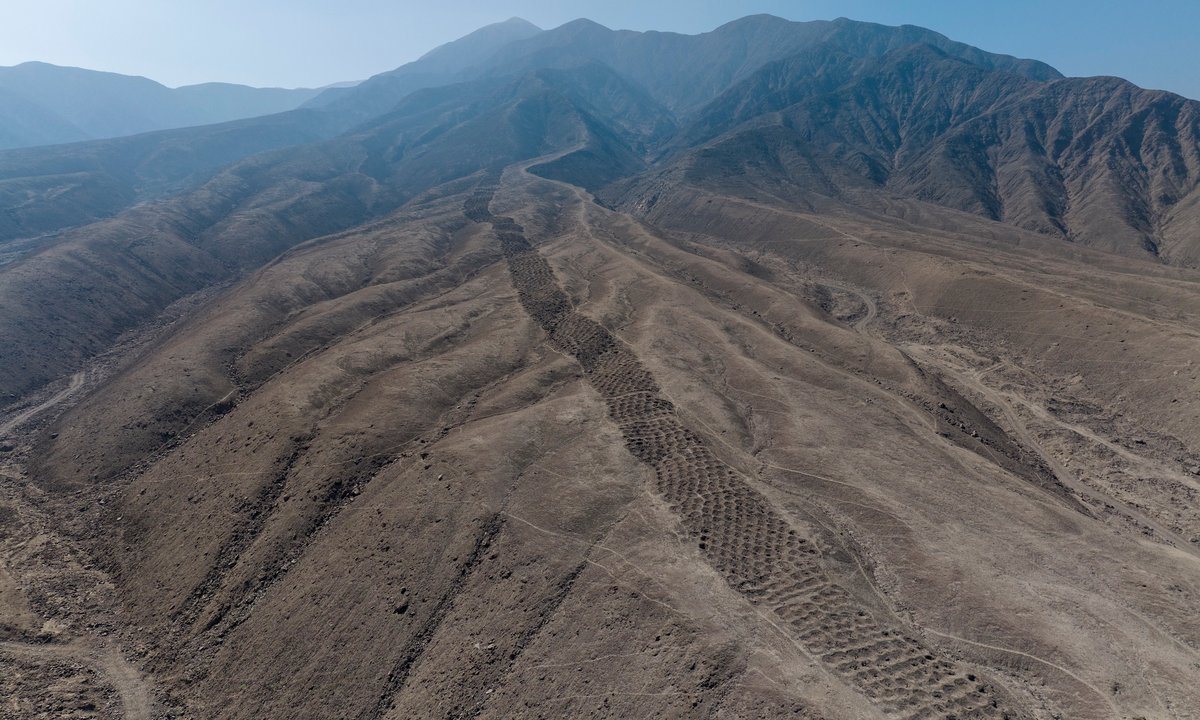
"Stretching for 1.5km along a ridge of Peru's Pisco Valley, and 14m to 22m wide, the site consists of around 5,200 aligned holes, each up to 2m in diameter and up to 1m in depth. Along the band, the holes are organised into around 60 sections separated by empty spaces. These sections can differ in their number of holes-one section has nine rows of eight holes, for example, while another has six rows of seven holes with a final row of eight."
"This unique monument was probably built by the Chincha Kingdom between AD1000 and AD1400, and continued in use under the Inca Empire from 1400 until 1532. It first rose to fame in 1933, when The National Geographic Society published aerial photographs of the site. Since then, experts have proposed numerous theories for how ancient Peruvians might have used the band of holes: from defence, storage, accounting and water collection, to fog capture, gardening, mining and as a burial ground."
A band of around 5,200 precisely aligned holes at Monte Sierpe stretches 1.5 km along a ridge in Peru's Pisco Valley and measures 14–22 m across. Each hole reaches up to 2 m in diameter and 1 m in depth and the holes are grouped into roughly 60 sections separated by empty spaces, with section layouts varying in row and column counts. The monument was probably built by the Chincha Kingdom (AD1000–1400) and remained in use under the Inca Empire until 1532. High-resolution drone imagery documented the layout and sediment samples were collected from 19 holes for microbotanical analysis. The layout and possible khipu-like mirroring suggest functions related to trade, exchange and accounting.
Read at The Art Newspaper - International art news and events
Unable to calculate read time
Collection
[
|
...
]