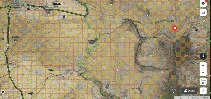
Two hunters scouting Elk Mountain discovered that access was obstructed not by terrain but by a checkerboard pattern of land ownership. Checkerboard areas alternate single square-mile public and private parcels across large parts of the American West. The pattern originated when the U.S. government granted alternating sections to railroad companies after the Civil War to promote rail construction and settlement while retaining intervening sections to sell later. The alternating ownership often leaves public parcels difficult to reach because crossing private land requires permission, producing long-term complications for access and land use.
"The checkerboard is a pattern of land ownership, unique to the American West, found in huge areas from New Mexico all the way up to Washington. On a map, these particular areas resemble a checkerboard, but instead of alternating black and white squares, checkerboarded land alternates between single square-mile parcels of public land and square mile parcels of private land."
"The checkerboard was created at the tail-end of the Civil War, when the U.S. government gave the railroad companies long corridors of land-up to eighty miles wide-on which to build new rail lines and encourage westward migration. But almost all of this land was given away in alternating, one-square-mile sections. This checkerboard pattern allowed the government to keep all the undeveloped sections in between and wait for them to go up in value before turning around and selling them to developers."
Read at 99% Invisible
Unable to calculate read time
Collection
[
|
...
]