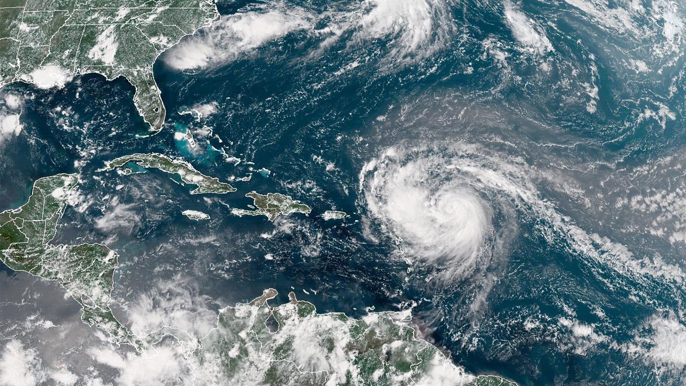
"The storm is forecast to produce heavy rainfall through Sunday, with dangerous surf and rip currents impacting areas along the East Coast, Bahamas' beaches and Atlantic Canada next week."
"Erin, which on Friday was at a Category 1, was over the Atlantic Ocean, moving toward the west near 17mph, expected to turn toward west/northwest Saturday night and decrease speed."
"Interests in Bermuda should monitor the progress of Erin since there is a risk of strong winds, heavy rainfall, and high surf by middle part of next week."
"Erin becomes 2025's first major hurricane as storm intensifies."
The storm named Erin is expected to produce heavy rainfall through Sunday, affecting the East Coast, Bahamas, and Atlantic Canada. Currently a Category 1 hurricane, Erin is moving west at 17 mph and is anticipated to turn toward the northwest, slowing before turning north next week. Bermuda is advised to monitor Erin due to forecast strong winds and high surf by mid-next week. Erin is identified as the first major hurricane of 2025 as it continues to intensify.
Read at Axios
Unable to calculate read time
Collection
[
|
...
]