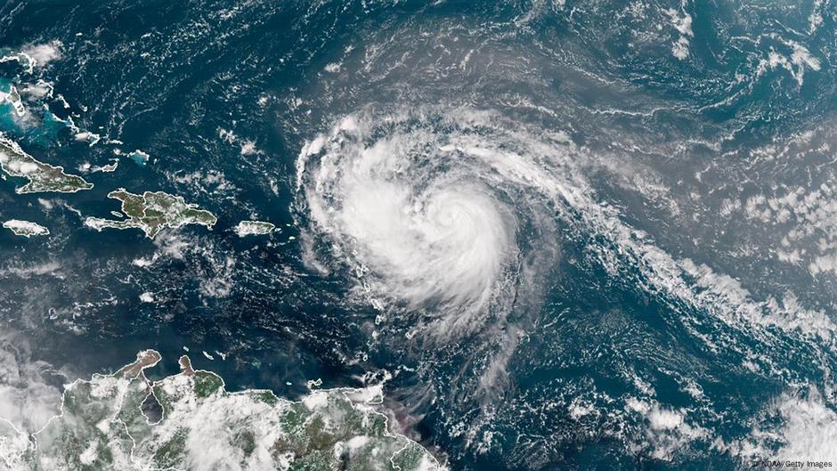
Hurricane Erin has intensified into a Category 4 storm, situated about 150 miles northeast of Anguilla with wind speeds reaching 130 mph. The National Hurricane Center announced that tropical storm watches are in effect for multiple islands. Heavy rainfall, expected to reach up to 4 inches with isolated totals of 6 inches, poses risks for flooding and landslides. While dangerous swells are anticipated, the likelihood of direct impacts along the east coast of the United States is diminishing. Forecasts predict Erin will turn northeast, affecting Bermuda as it bypasses Puerto Rico.
"Hurricane Erin strengthened into a category 4 hurricane with maximum sustained winds of 130 mph, threatening flooding and landslides in affected areas."
"Tropical storm watches have been issued for several islands as up to 4 inches of rain are expected, with localized totals potentially reaching 6 inches."
"The NHC noted the possibility of dangerous swells, but the chance of direct impacts in the Bahamas and along the east coast of the US is decreasing."
"Forecasts indicate Hurricane Erin will take a sharp turn northeast, potentially impacting Bermuda while passing 200 miles north of Puerto Rico."
Read at www.dw.com
Unable to calculate read time
Collection
[
|
...
]