"The thunderstorms will remain a slight risk because of a cold front that ushered in unstable air Monday. By Tuesday, the cold front will have moved away from L.A., but the cold core of the low-pressure system will still be around. "This will bring enough instability to the area for a slight chance of thunderstorm development," the weather service in Oxnard said."
"Thursday's storm is expected to drop from 0.25 to 0.75 inches of precipitation. That's on top of the 0.74 inches of rain that fell on downtown L.A. in the 24-hour period that ended at 9 p.m. Monday. Before that, the weekend storm that began Friday brought 2.68 inches of rain to downtown. For the 24-hour period ending 9 p.m. Monday, Porter Ranch received 1.61 inches; La Cañada Flintridge, 1.5; Northridge, 1.43; Bel-Air, 1.21; Castaic, 1.15; Van Nuys, 1.12; and Beverly Hills, 1.11."
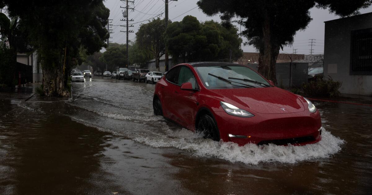
Showers could linger in Los Angeles on Tuesday after four consecutive days of rain, with a 20% to 30% chance of showers and thunderstorms across much of Los Angeles County. A cold front produced unstable air, keeping thunderstorms a slight risk, and the cold core of the low-pressure system will maintain enough instability for a slight chance of thunderstorm development. Coastal and valley temperatures chilled into the 50s, with some areas reaching the mid-60s. Sunny skies are expected Wednesday. Another storm will enter Southern California Thursday through Friday, bringing 0.25 to 0.75 inches of precipitation and adding to recent heavy totals.
Read at Los Angeles Times
Unable to calculate read time
Collection
[
|
...
]