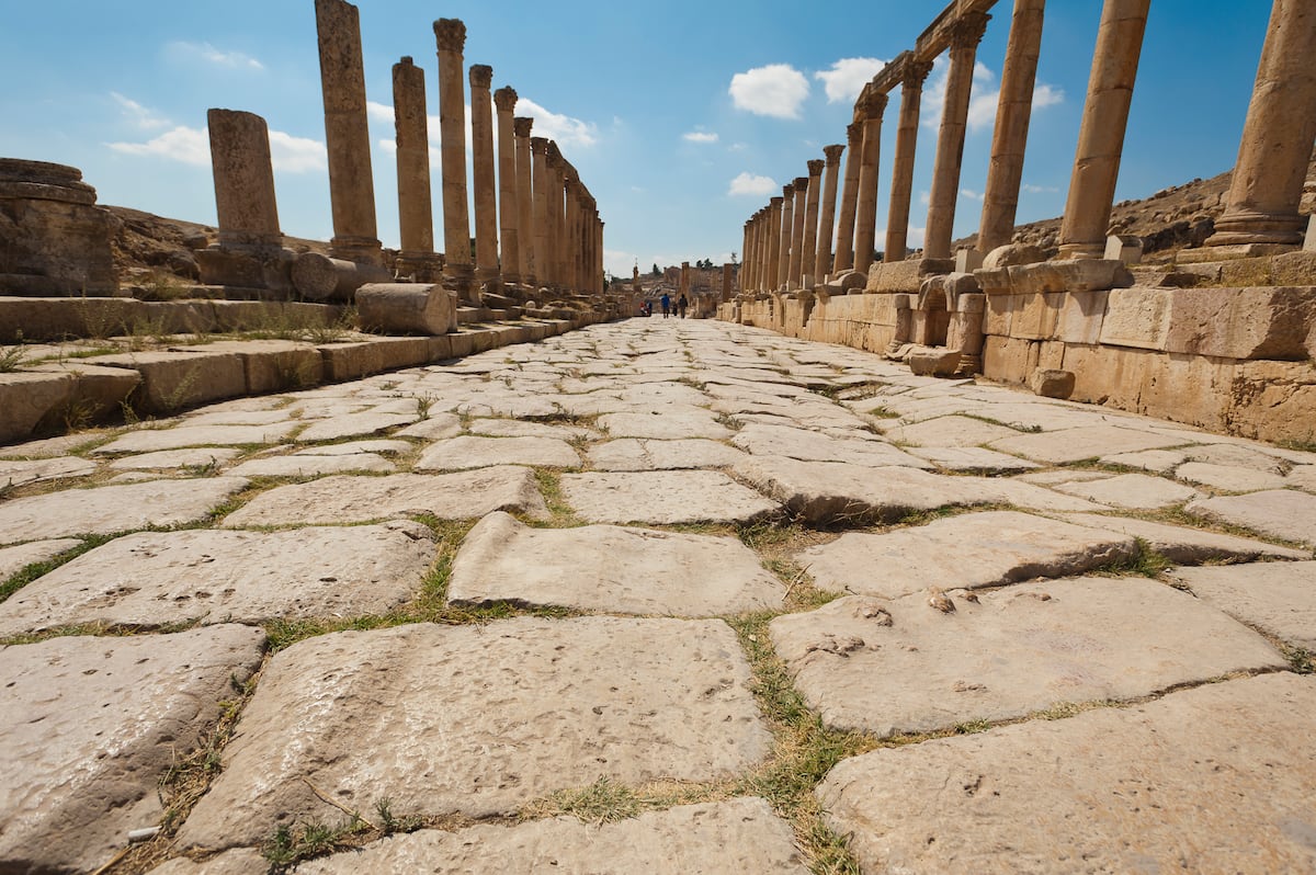
Modern geographic information systems have identified 186,000 miles of Roman roads and highways by combining historical and archaeological sources. Cylindrical or rectangular miliaria were placed every mille passus to mark distances along routes. The reconstructed network proved almost twice as extensive as earlier estimates, while very little of the original layout survives. Road surfaces consisted of successive layers of gravel with a compacted fine-gravel top and paving primarily at city exits. Roads were raised and crowned for drainage and suited unshod horses. Reconstructed routes and data are available on the Itiner-e digital atlas.
"A large group of researchers has turned to the latest technology to delve into historical and archaeological records in order to reconstruct the road map from 2,000 years ago. What they discovered is that it was far more extensive almost twice as large as previously believed. They also found that very little of its original layout remains. The results of their work, published in Scientific Data, have been compiled and made publicly available on Itiner-e, a digital atlas of the roads that began or ended in Rome."
"Another misconception we wanted to dispel is that they were paved with stone slabs, like the Via Appia. In fact, they were built in successive layers of gravel, each finer than the last, with the top layer made of compacted fine gravel. That was best for horses, which at the time still didn't wear horseshoes, adds the archaeologist."
Read at english.elpais.com
Unable to calculate read time
Collection
[
|
...
]