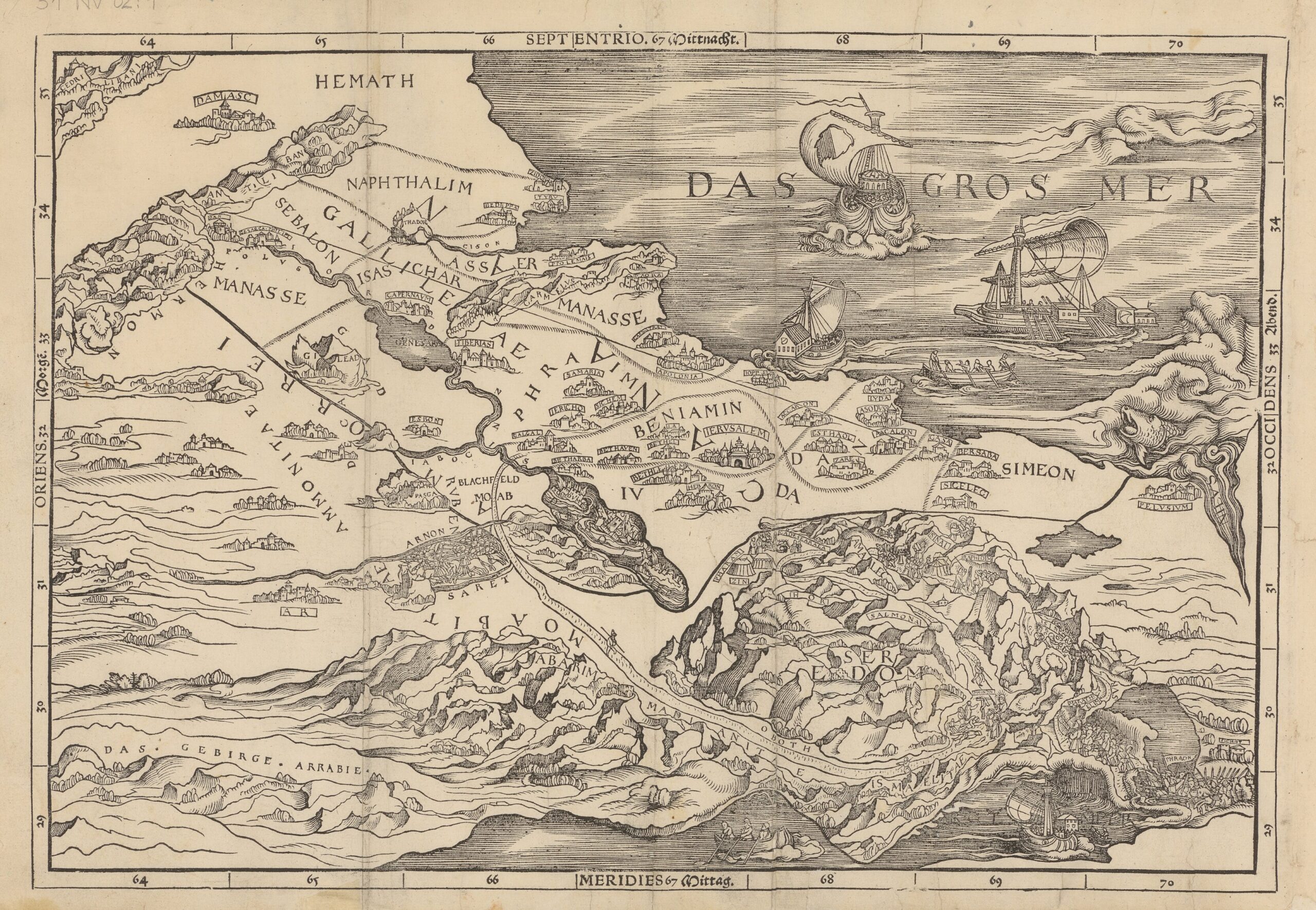
"They printed the map backwards so the Mediterranean appears to the east of Palestine. People in Europe knew so little about this part of the world that no one in the workshop seems to have realised. But this map transformed the Bible forever and today most Bibles contain maps."
"The 1525 Old Testament printed by Christopher Froschauer survives in only a handful of copies worldwide, including one preserved at Trinity College Cambridge's Wren Library. Within its pages is Cranach's pioneering Holy Land map, showing the stages of the Israelites' wilderness wanderings and the division of the Promised Land into the twelve tribal territories."
"These territorial lines were rooted in Christian traditions that emphasised inheritances and sacred claims to biblical sites. Cranach drew on medieval precedents and on the 1st-century historian Josephus, who simplified the often contradictory geographical descriptions in the Book of Joshua."
The 1525 Old Testament printed by Christopher Froschauer contains Lucas Cranach the Elder's Holy Land map, printed backwards so the Mediterranean appears to the east of Palestine. The map depicts Israelites' wilderness wanderings and the division of the Promised Land into twelve tribal territories. Cranach relied on medieval precedents and the 1st-century historian Josephus to simplify conflicting geographic descriptions in Joshua. The territorial lines reflect Christian traditions of inheritance and sacred claims to sites. The reversed orientation went unnoticed by contemporary European printers yet the map influenced subsequent Bibles and the notion that map lines can signify meaningful territorial divisions.
Read at Medievalists.net
Unable to calculate read time
Collection
[
|
...
]