Early medieval maps placed Asia at the top, Europe left, Africa right, with the Mediterranean central, often showing Britain as a small island or ambiguous mark. The Albi Mappa Mundi (8th century) may portray Britain as a lower-left outline, though uncertainty remains. The late tenth-century map linked to Abbo of Fleury depicts three islands labelled Britannia, Hibernia, and possibly Tili (Thule). The Anglo-Saxon Mappa Mundi (c.1025–1050) renders Britain and Ireland as distinct islands, names towns such as London, Winchester, and Dublin, and preserves Roman provincial names, reflecting classical geographical traditions. Maps combined theological, classical, and local knowledge to reimagine Britain over time.
"The Mappa Mundi of Albi, dating to the 8th century, is among the oldest surviving world maps. Like many medieval maps, it presents Asia at the top, with Europe on the left and Africa on the right, while the Mediterranean Sea dominates the centre. Some have suggested it may even be the first map to depict Britain: if you look closely in the lower-left corner, there seems to be the outline of an island. Then again, it could just be a smudge."
"Our next depiction of Britain is a little clearer. A world map linked to the French monk Abbo of Fleury (c. 945-1004) was produced around the end of the tenth century, and it places three small islands near the upper-left of the diagram. They are labelled Britannia and Hibernia, along with a third name that appears to read Tili. In other words, we are looking at Britain and Ireland, plus what may be Thule-a far-northern place-name that later writers sometimes connected with Iceland."
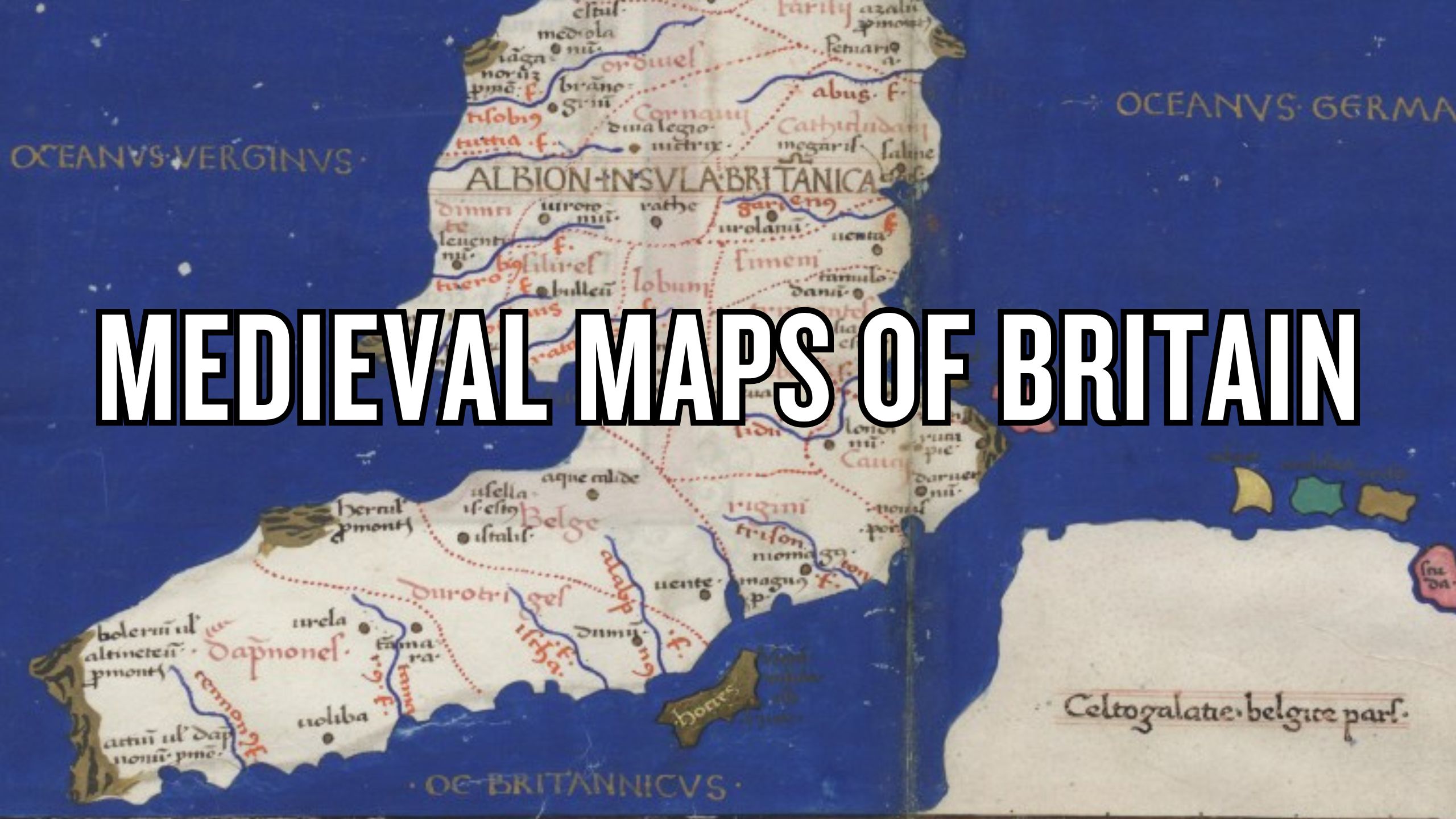
"Like other medieval mappae mundi it is not a "map of Britain" so much as a diagram of the known world, but its treatment of north-western Europe is unusually clear. Britain and Ireland appear as small but distinct islands, and the map goes beyond outlines by naming places and marking key centres. London, Winchester, and Dublin are indicated using Roman-style town symbols, while the map also preserves the names of Roman provinces, showing how strongly it draws on older geographical traditions."
Read at Medievalists.net
Unable to calculate read time
Collection
[
|
...
]