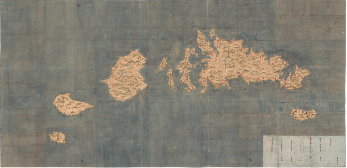
High-resolution digital images of the Ryukyu Kuniezu allow zooming and panning across three enormous 17th-century hand-drawn maps, revealing coastal inlets, settlements, and fine cartographic features. The maps depict the Ryukyu Islands as an interconnected maritime world with long island chains between southern Japan and Taiwan and Okinawa at the centre. Careful rendering of coastlines and island spacing conveys how geography influenced political and economic life. The Ryukyu Kingdom unified in 1429 under a ruler at Shuri and developed into a maritime trading state linking Japan, China, Korea, and Southeast Asia through tributary ties and commerce. The Historiographical Institute at the University of Tokyo digitised the maps, led by Professor Satoru Kuroshima.
"The University of Tokyo has made the Ryukyu Kuniezu available through a high-resolution digital viewer, allowing anyone to explore these vast charts in remarkable detail-right down to individual place names and fine cartographic features. The Ryukyu Kuniezu consists of three large hand-drawn maps depicting the Ryukyu Kingdom and its island groups. Dating to the 17th century, each map measures several metres across, making them difficult to display or study in person."
"The maps present the Ryukyu Islands as a connected maritime world. Long chains of islands stretch across the sea between southern Japan and Taiwan, with Okinawa at the centre. The careful rendering of coastlines and the spacing between islands give a clear sense of how geography shaped political and economic life. Even without reading every label, viewers can see how certain areas are emphasised, how shorelines were understood, and how the kingdom visualised its own territory."
Read at Medievalists.net
Unable to calculate read time
Collection
[
|
...
]