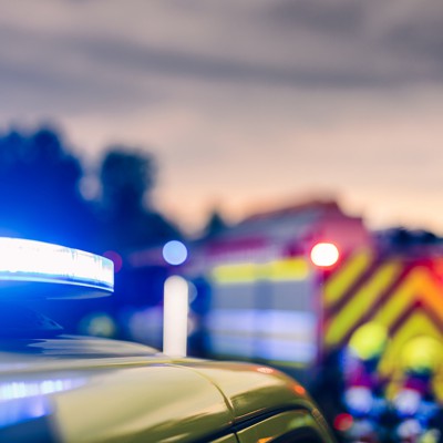
"When disaster strikes, first responders are expected to sprint into chaos while everyone else runs away. Whether it's a collapsed building after an earthquake or a smoke-filled office during an active shooter event, the ability to see around corners and know what's happening inside a dangerous environment can be the difference between life and death. Emerging technology from government labs is beginning to give emergency crews advantages they didn't have even a decade ago."
"Drones have started to earn their place in public safety by supporting missions such as search and rescue and surveillance. In the military, they are even becoming decisive frontline weapons, demonstrating their versatility. However, most of those kinds of activities take place outside where a drone can really spread its wings or its propellers, and also receive strong guidance signals to help it navigate. But once the danger moves indoors, drones and the technologies that help drive them, like GPS, can't easily follow."
"One major challenge responders face is simply understanding any indoor environment they're entering. In many disaster scenarios, sending a human into a building full of fallen debris, compromised structural supports and unpredictable hazards is a high-risk proposition. A better option is to send in a drone first, but only if the drone can reliably navigate complicated interiors and relay useful information back to the team in real time."
Emerging technologies from government labs are equipping emergency crews with better ways to see inside hazardous buildings and to locate people during incidents. Drones support missions such as search and rescue and surveillance but face challenges indoors because GPS and guidance signals degrade. Sending drones into compromised interiors can reduce risk to humans if drones can reliably navigate, map in 3D, capture sensor data, identify hazards, and stream information in real time. NIST sponsored a prize challenge to push improvements in 3D indoor mapping. Indoor location tracking is also advancing to become part of the first responder toolkit.
Read at Nextgov.com
Unable to calculate read time
Collection
[
|
...
]