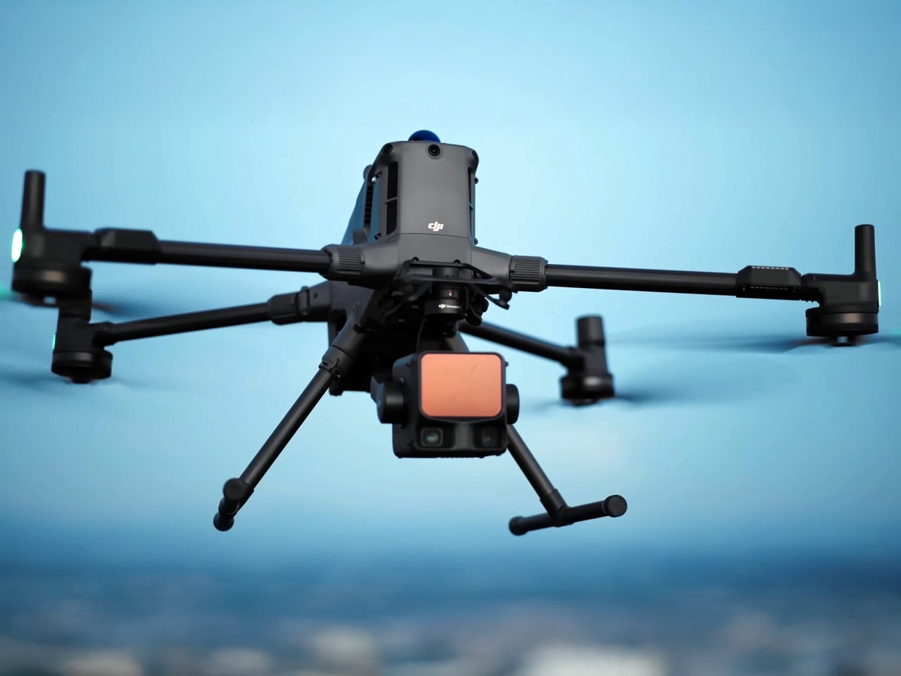
"DJI just made professional-grade aerial LiDAR look affordable - for companies, governments, and organizations, at least. The Zenmuse L3, launched November 4, packs technology that would typically cost $150,000 to $250,000 into a $14,600 package that weighs just 1.6 kilograms. Its dual 100-megapixel cameras and laser system can map 100 square kilometers per day with centimeter-level precision - capabilities that open doors far beyond traditional surveying into realms like archaeological discovery and terrain analysis that were previously the domain of well-funded research institutions."
"DJI's launch video has racked up over half a million views, suggesting that even those who can't justify the five-figure price tag (like me, for example) are fascinated by what the system can do: strip away forest canopies with laser precision, reveal hidden terrain features, and create detailed 3D models of landscapes that might conceal everything from ancient ruins to forgotten infrastructure"
"So here's the thing about LiDAR that makes it fundamentally different from just strapping a really good camera to a drone. Cameras see surfaces, whatever light bounces back to the lens. LiDAR shoots invisible laser pulses at the ground, measures how long they take to bounce back, and uses that timing to calculate exact distances. Fire enough of these pulses fast enough, in enough directions, and you're essentially building a 3D point cloud of everything below you."
The Zenmuse L3 combines dual 100-megapixel cameras and a high-rate laser system into a 1.6 kg package priced at $14,600, offering centimeter-level precision. The system can map up to 100 square kilometers per day and fires up to 2 million laser pulses per second to build dense 3D point clouds. Target users include professional surveyors, utility companies, and mining operations, while applications extend to archaeological discovery, terrain analysis, and revealing hidden infrastructure beneath forest canopies. The L3 reduces traditional LiDAR cost and logistical barriers, enabling broader organizational access to high-resolution aerial mapping.
Read at Yanko Design - Modern Industrial Design News
Unable to calculate read time
Collection
[
|
...
]