"Heavy rain will move over south Wales from late Sunday and through Monday. Whilst rainfall amounts will vary, the largest accumulations are expected over the highest ground in south Wales and could reach 100-120mm through the day. 60-80mm is most likely for many hills within the Amber warning area, while those to lower levels should see around 20-40mm through the day."
"With some rivers already swollen and the ground saturated, we expect to see a number of flood alerts and warnings issued. We also expect the rain to cause surface water issues. We're urging people to be vigilant and to make preparations for potential flooding now. You can check if you live in an area at risk of flooding on our website and sign up for our free flood warning service."
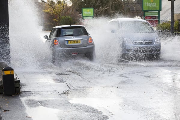
Predominantly dry conditions on Sunday will turn more unsettled overnight as rain returns, becoming most significant overnight Sunday into Monday. Heavy rain will move over south Wales from late Sunday through Monday, with largest accumulations on high ground potentially reaching 100–120mm, 60–80mm on many hills in the Amber warning area, and 20–40mm at lower levels. An Amber warning for south Wales will be in force from early Monday through early Tuesday, while wider yellow warnings cover parts of England, Wales, and southwest Scotland. Flooding, travel disruption, surface water issues, and possible power cuts are expected; fast-flowing or deep water may present a danger to life. People are urged to be vigilant, prepare for flooding, check local flood risk, and sign up for flood warnings.
Read at London Business News | Londonlovesbusiness.com
Unable to calculate read time
Collection
[
|
...
]