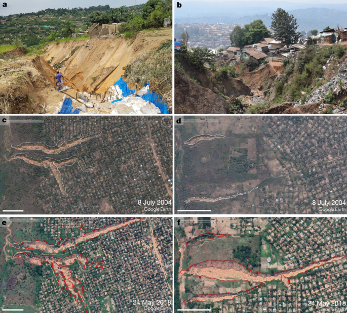
All cities in the DRC assigned official status as 'city' by presidential decree or with at least 80,000 inhabitants in 2020 were included. Presence of urban gullies (UGs) was assessed using very high-resolution Google Earth imagery (≤1 m). A UG was defined by geomorphic criteria: channel eroded by concentrated runoff, elongated shape, discernible thalweg, gully head and visible edges, thalweg oriented for effective runoff evacuation, and location within 200 m of buildings. Field surveys of 434 gullies in Kinshasa, Kikwit and Bukavu validated mapped features but revealed smaller undetected UGs. Analyses were restricted to UGs with thalwegs ≥30 m to reduce detection bias. Historical 1950s aerial photographs were checked to assess links to urban growth and road networks.
"We first identified all cities in the DRC that were significantly affected by UGs. For this, we checked all urban centres that were assigned the official status of 'city' by presidential decree (Articles 53-55 of Decree Law 081 of 2 July 1998) as well as other urban centres with at least 80,000 inhabitants in 2020 (according to ref. ) that show characteristics of small cities. This list can be considered exhaustive."
"We considered a feature to be a UG if it could be recognized as such, based on commonly accepted geomorphic criteria. More specifically, the feature had to be recognizable as a channel eroded by concentrated runoff with an elongated shape, a discernible thalweg, a gully head and visible gully edges. Furthermore, the thalweg needed to be oriented along the steepest slope or in another way that allowed effective runoff evacuation (for example, following a road downslope)."
Read at Nature
Unable to calculate read time
Collection
[
|
...
]