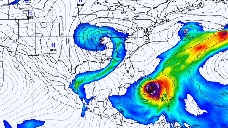
Most rain will end by or just after sunrise Friday. Heavy rain and wind will affect the area late Thursday afternoon into Thursday night as low pressure moves from the Tennessee River Valley into Pennsylvania, New York, and then northward through Maine into the Canadian Maritimes. Hurricane Melissa has devastated Jamaica and Cuba, and trillions of gallons of water are moving northward as Melissa weakens approaching Bermuda and later travels into the North Atlantic. By the time clocks return to standard time Sunday, the low-pressure system may merge with Melissa's outer bands and could send rain to the British Isles early next week. The timing and evolution of that merger will determine forecast impacts.
"Over the next few days, we're going to see countless images coming out of Jamaica and Cuba showing the sheer devastation that Hurricane Melissa has wrought. Trillions of gallons of water will then be moved northward within this weather system as the hurricane continues to lose strength on its approach to Bermuda before eventually moving into the North Atlantic. While all of this is going on in the atmosphere, low pressure will be moving from the Tennessee River Valley into Pennsylvania,"
"The atmosphere is a dynamic swirl of energy being transported across the planet in a never-ending attempt to achieve balance. In addition to pockets of energy, areas of moisture, including the rain we're going to see on Thursday, move from point A to point B. One of the fascinating things about weather systems is that they can interact with one another sometimes in meaningful ways and other times just enough for one of them to enhance the other."
Read at Boston.com
Unable to calculate read time
Collection
[
|
...
]