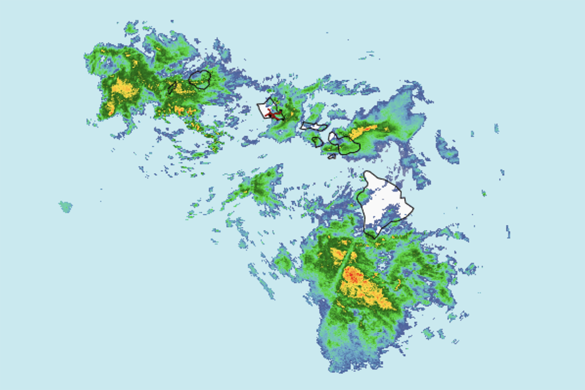
"We're not expecting much in terms of winds, mainly just going to be flood potential. And thinking that the focus is going to be Oahu, Maui County and Big Island, with Kauai kind of being on the fringes of it versus, you know, all the Islands were impacted last time."
"The risk of flooding is heightened by already saturated ground, making some areas more susceptible than others. But Foster emphasized, 'If you were spared on the last one and you didn't get much impact, that doesn't mean this one won't impact you.'"
"In advance of the storm, crews are staging equipment, clearing culverts and inspecting drains for obstructions at inlets and outlets. Oahu is also monitoring the storm and prepping in advance of it."
Hawaii faces a second kona low storm arriving late Thursday, following last week's destructive weather that caused flooding, downed trees, power outages, and road closures. Unlike the previous storm, which brought strong winds and up to 46 inches of rain, this incoming system is expected to be primarily a rain event, raising significant flooding concerns. The National Weather Service forecasts the main impact will affect Oahu, Maui County, and the Big Island, with Kauai on the fringes. Saturated ground from the previous storm heightens flood risk. Officials are preparing by staging equipment, clearing culverts, and inspecting drains. The storm is expected to linger into Monday as it moves past the Big Island.
Read at SFGATE
Unable to calculate read time
Collection
[
|
...
]