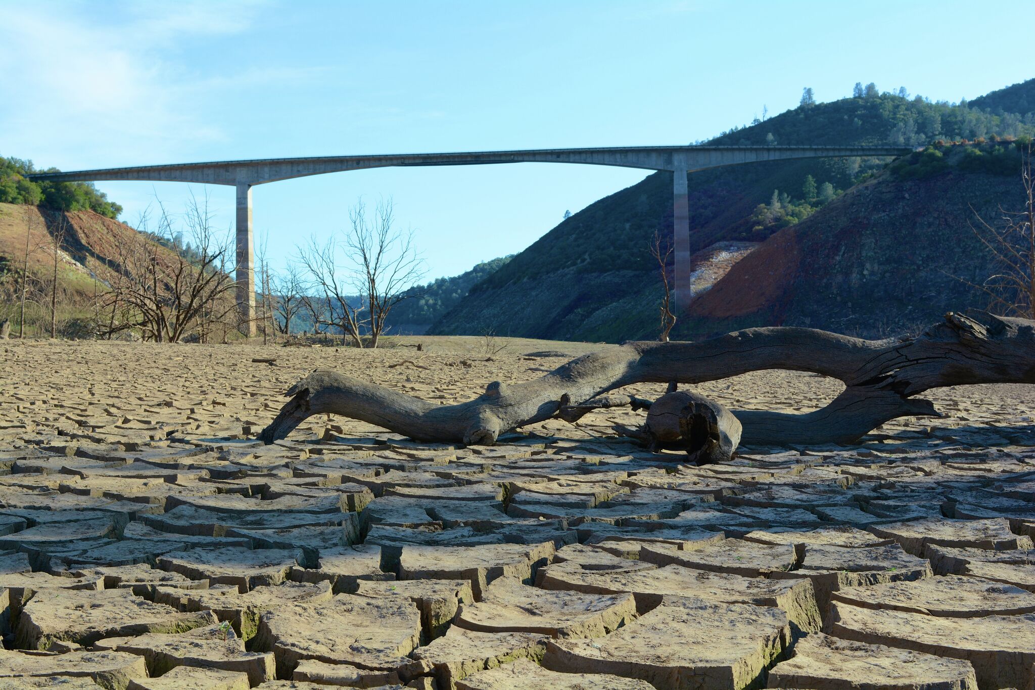
"Highway 49 between Calaveras and Tuolumne counties was paved on winding knolls of grass that by early August turn crunchy and amber from torrid temperatures. Its two lanes trace the western Sierra slope past bucolic farmland and through a series of tight corners before approaching the Stevenot Bridge, where the perspective completely changes. That's when a panoramic view of New Melones Lake takes hold."
"If a vast lake seems out of place within the dense oak woodland at the foot of the Sierra Nevada, it's by design. New Melones is human-made, a reservoir that's not even 50 years old. These golden foothills, surrounded by the lake's 100-mile shoreline, once encased centuries of California history before the Bureau of Reclamation dammed the Stanislaus River in 1978 - mostly in the name of flood control following a once-in-a-generation storm that devastated the West."
Highway 49 winds along western Sierra slopes and reveals a panoramic view of New Melones Lake at the Stevenot Bridge. The lake is human-made, created when the Bureau of Reclamation dammed the Stanislaus River in 1978 for flood control after a catastrophic storm. The reservoir has a 100-mile shoreline and is the fourth-largest in California. Exposed contours and bathtub rings mark historic waterlines. The surrounding oak foothills supported nearly 10,000 years of human habitation, including Me-Wuk sites and a Gold Rush town now submerged beneath the reservoir.
Read at SFGATE
Unable to calculate read time
Collection
[
|
...
]