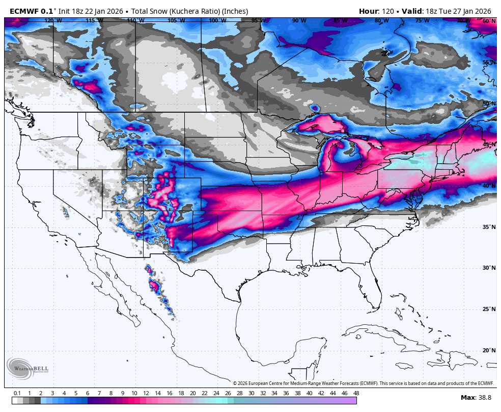
"This storm is lining up as a sprawling, long-duration winter hit from the Southern Plains through New England. The setup is a strong Arctic air mass already in place, with a low tracking along its southern edge and pulling in enough moisture to generate heavy precipitation over a huge footprint. The storm is expected to track from the Southern High Plains on Friday, across the Mid-South and Ohio Valley on Saturday, then through the Mid-Atlantic and Northeast on Sunday."
"The cold side of the system supports heavy snowfall approaching a foot with locally higher amounts possible, while the warm side favors sleet and freezing rain from Texas into parts of the Mid-South and the Carolinas and Virginia Piedmont. Arctic air and gusty winds also expand eastward, so the cold lingers and wind chills could turn dangerous, especially if ice-driven power outages occur. Texas sits near the southern edge of the snow shield, so the most disruptive impacts come from ice and sleet."
"Farther east, the Dallas-Fort Worth region leans into a glaze-and-sleet event, with ice of roughly 0.25 to 0.5 inches of ice possible and sleet totals of 2 to 5 inches from around I-20 northward. Around Austin and San Antonio, ice remains in play, around 0.1 to 0.25 inches, with pockets up to a half inch possible. Temperatures plunge behind the storm, so any ice that forms holds on and keeps travel slow even after the last flakes (or pellets!) fall."
A strong Arctic air mass combined with a low tracking along its southern edge will yield a sprawling, long-duration winter storm. The system will move from the Southern High Plains on Friday through the Mid-South and Ohio Valley on Saturday, reaching the Mid-Atlantic and Northeast on Sunday. Cold-side impacts include heavy snowfall approaching a foot or more in places, while the warm side favors sleet and freezing rain from Texas into parts of the Mid-South, the Carolinas, and the Virginia Piedmont. Texas faces a mix of sleet and ice, with the Panhandle seeing several inches of snow. Northern and central Oklahoma favor heavier snow, and arctic air plus gusty winds will prolong dangerous wind chills and increase risk of ice-driven power outages and disrupted travel.
Read at SnowBrains
Unable to calculate read time
Collection
[
|
...
]