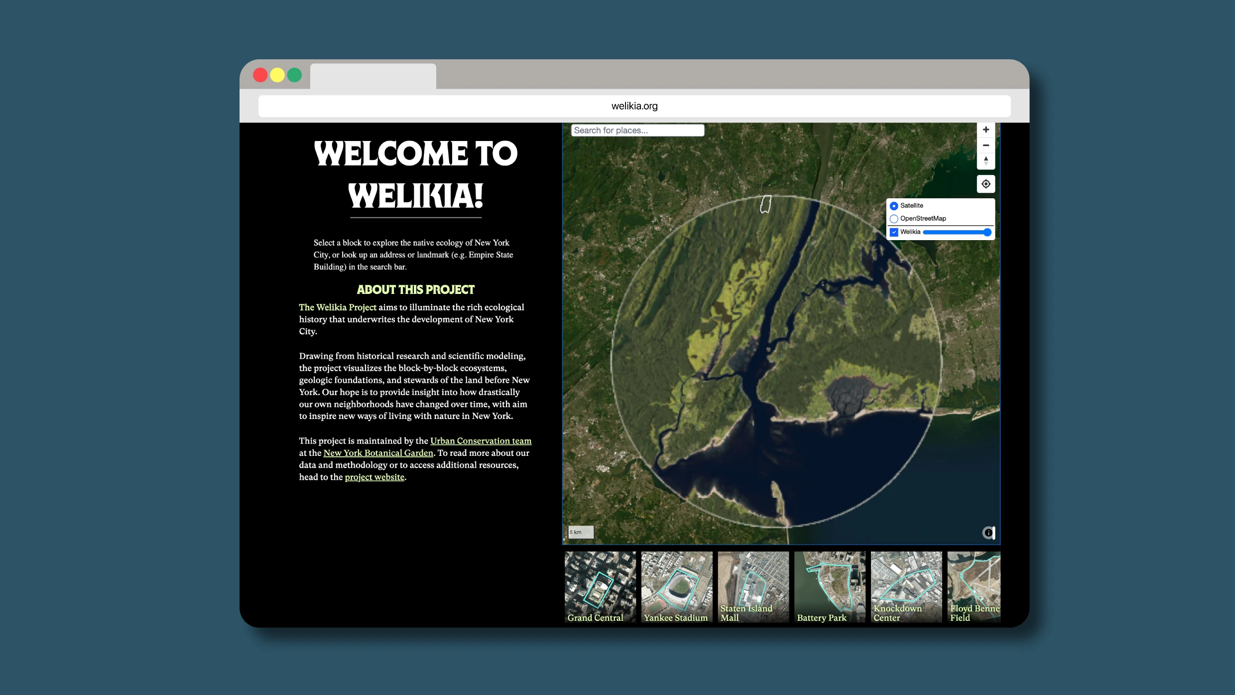
"The Welikia Project allows users to explore the ecological history of New York City, highlighting how flora, fauna, and Indigenous people shaped the urban landscape."
"Eric Sanderson emphasizes that the map fosters a deeper connection for New Yorkers to their city while serving as a valuable tool for urban planning and flood prevention."
"The name 'welikia' reflects the history of the Lenape people, indicating a long-standing relationship with the land we now know as New York City."
"Sanderson's discovery of historical maps ignited his passion for studying New York's past ecology, revealing a rich narrative of land transformation over centuries."
The Welikia Project, created by the New York Botanical Garden, features an interactive map showing what New York City looked like 400 years ago. Users can search specific locations to see historical flora, fauna, and Indigenous land usage before urbanization. Named after the Lenape word for 'my good home,' the project led by Eric Sanderson aims to connect New Yorkers to their environment and assist urban planners. Sanderson’s interest was sparked by historical maps, providing a detailed glimpse into NYC's ecological evolution over the centuries.
Read at Fast Company
Unable to calculate read time
Collection
[
|
...
]